Flood plain is waterlogged after days of rain


Herald chief photographer Stephen Goodger captured the scene from the top of Steyning Bowl on Thursday.
He said the water levels were high, but nowhere near the worst he had seen over his time on the newspaper, including a few years ago, when the grassy area east of the A283 resembled a river.
Advertisement
Hide AdAdvertisement
Hide AdThe major river floodplains in the eastern part of the South Downs are made up of a series of enclosed fields, bounded by ditches and occasional hedgerows.
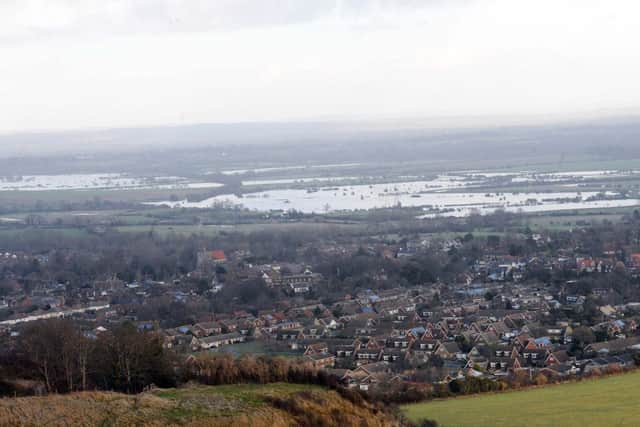
The River Adur flood plain, beyond Steyning and Upper Beeding, is part of a wide, flat area at the base of a distinctive U-shaped valley.
The Environment Agency said the main source of flood risk in the Adur area was from the river, made worse by the influence of the tide and surface water flooding.
Flood risk management in the Adur catchment has historically relied on the flood defence embankments along the River Adur, north of the A259 road bridge and beyond Steyning and Upper Beeding.
Advertisement
Hide AdAdvertisement
Hide AdIn Steyning and Upper Beeding, a combination of high tide and increased river levels can lead to overtopping of the defences.
The agency’s flood management plan states: “Extended periods of high water levels in the River Adur prevent drainage from land behind the defences, often causing the land to become seasonally waterlogged.
“This can produce a flashy response to heavy rainfall resulting in surface water flooding. This can also, on occasions, overwhelm nearby urban drainage systems resulting in localised urban flooding.”